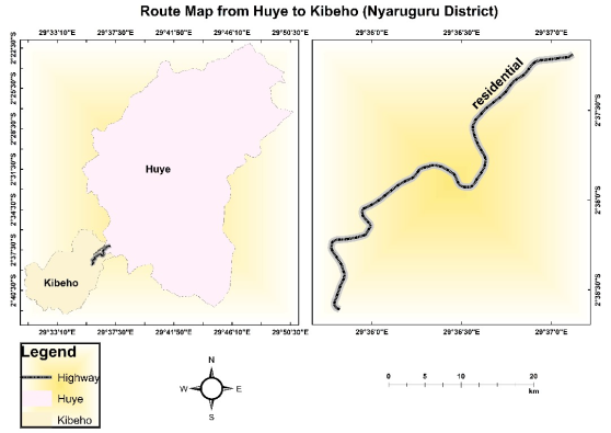
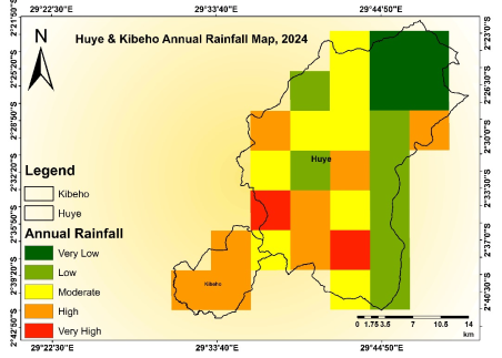
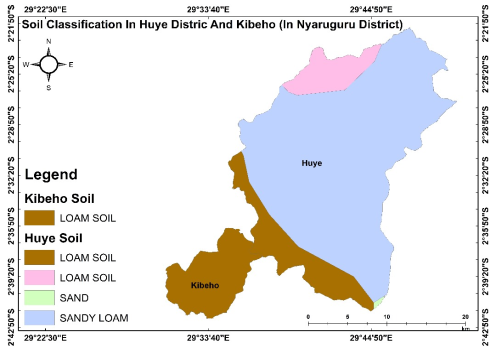
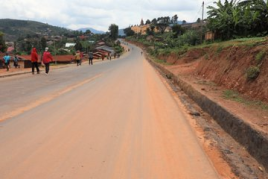
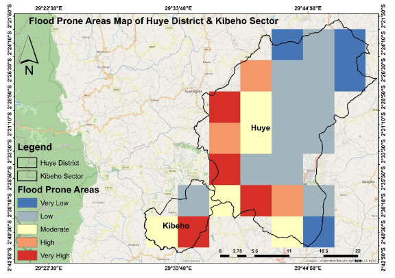
Flooding risks pose significant challenges to road infrastructure construction globally, causing delays, cost overruns, and reduced durability. In Rwanda, these challenges are particularly evident due to high rainfall intensity, frequent floods, and inadequate drainage systems, which exacerbate road damage and soil erosion. The Huye-Kibeho road construction project in Southern Rwanda has faced substantial delays and cost increases as a result of these flooding risks. This study examines the impact of flooding risks on road infrastructure construction, with a focus on the Huye-Kibeho road project. The research employs a descriptive survey design, utilizing both quantitative and qualitative methods. Data was collected through structured questionnaires and key informant interviews. The structured questionnaires, incorporating both closed-ended and Likert scale questions, will capture quantitative data, while interviews will provide deeper insights into the flooding-related challenges faced during construction. The analysis will include descriptive statistics (e.g., means, frequencies, and percentages) to summarize the findings, and inferential statistics, specifically correlation and regression analysis, was used to assess the relationship between flooding risk factors and road infrastructure performance. The regression analysis indicates a significant relationship between flooding factors and road construction, with flooding factors explaining 62.5% of the variance in construction delays and cost overruns (R² = 0.625, F (6, 137) = 378.171, p < 0.001). Qualitative data from interviews was analyzed thematically to identify recurring patterns related to the impact of flooding risks. The combination of these methods provides a comprehensive understanding of the issue. The study confirms that flooding risks have a substantial impact on road infrastructure construction, specifically on the Huye-Kibeho road project. The findings highlight significant delays and cost overruns linked to flooding factors, including high rainfall intensity, flood frequency, floodwater depth, soil erosion, drainage system inefficiencies, and the region’s topography. These challenges not only hinder the construction progress but also jeopardize the long-term durability and lifespan of the road. Based on the findings, it is recommended that the Huye-Kibeho road construction project implement enhanced flood mitigation measures, including the development of a robust drainage system, flood barriers, and soil stabilization techniques, to effectively manage the flooding risks and minimize the impact on construction delays, cost overruns, and long-term road durability.
| Published in | Journal of Energy, Environmental & Chemical Engineering (Volume 10, Issue 2) |
| DOI | 10.11648/j.jeece.20251002.11 |
| Page(s) | 38-55 |
| Creative Commons |
This is an Open Access article, distributed under the terms of the Creative Commons Attribution 4.0 International License (http://creativecommons.org/licenses/by/4.0/), which permits unrestricted use, distribution and reproduction in any medium or format, provided the original work is properly cited. |
| Copyright |
Copyright © The Author(s), 2025. Published by Science Publishing Group |
Flooding, Road Infrastructure, Resilience, Cost Overruns, Soil Erosion, Rwanda
Statement | Mean | Std. Dev. |
|---|---|---|
The rainfall intensity in the Huye-Kibeho area frequently causes significant flooding during the road construction. | 4.32 | 0.68 |
Rainstorms in this region have become increasingly intense, raising concerns about the risk of project delays. | 4.18 | 0.74 |
The heavy rainfall patterns in the Huye-Kibeho area make it difficult to maintain steady progress on road construction. | 4.25 | 0.71 |
The current road infrastructure design is inadequate to handle the intensity of rainfall experienced in Huye-Kibeho. | 4.08 | 0.8 |
The frequency and intensity of rainstorms in the region pose a high risk of waterlogging on the construction site. | 4.20 | 0.73 |
Sudden and intense downpours in the Huye-Kibeho area increase the flood risk, threatening the stability of the construction. | 4.30 | 0.69 |
Statement | Mean | Standard Deviation |
|---|---|---|
The Huye-Kibeho road project has been frequently disrupted by repeated flooding events. | 4.29 | 0.67 |
Floods in this area occur more often than initially anticipated, increasing the risk to the project's completion. | 4.26 | 0.70 |
The frequency of flooding in Huye-Kibeho poses significant risks to maintaining the road’s construction schedule. | 4.31 | 0.68 |
Recurrent floods in the Huye-Kibeho area have led to the degradation of key sections of the road infrastructure. | 4.28 | 0.72 |
The risk of project failure is heightened due to the frequency of flooding along the Huye-Kibeho road construction site. | 4.24 | 0.75 |
Frequent flooding has caused serious challenges for the stability and sustainability of the road infrastructure being developed. | 4.30 | 0.69 |
Statement | Mean | Standard Deviation |
|---|---|---|
The risk of soil erosion in the Huye-Kibeho region is high due to frequent flooding, affecting the road’s foundation. | 4.36 | 0.63 |
Flood-induced soil erosion has already caused considerable structural damage to parts of the road under construction. | 4.33 | 0.67 |
Erosion from floodwaters in this area poses a long-term risk to the stability and durability of the road infrastructure. | 4.32 | 0.66 |
The current erosion control measures are insufficient to mitigate the risks posed by floods in Huye-Kibeho. | 4.3 | 0.68 |
Flood-related erosion has led to the loss of construction materials, posing additional risks to road progress. | 4.34 | 0.65 |
The severity of soil erosion during floods in Huye-Kibeho threatens the overall success of the road project. | 4.31 | 0.69 |
Statement | Mean | Standard Deviation |
|---|---|---|
The drainage systems along the Huye-Kibeho road are inadequate to handle the volume of floodwater during heavy rains. | 4.42 | 0.61 |
Inefficient drainage systems increase the risk of flooding, leading to more damage to the road under construction. | 4.4 | 0.64 |
The current drainage infrastructure in the Huye-Kibeho project area has failed to mitigate flood risks effectively. | 4.35 | 0.67 |
Poor drainage systems in the region contribute to water accumulation, increasing flood risk for the construction site. | 4.38 | 0.63 |
The drainage systems designed for the Huye-Kibeho road construction do not sufficiently reduce the risks of flood damage. | 4.36 | 0.65 |
Efficient drainage systems are critical to managing the flood risks that are currently affecting the Huye-Kibeho road project. | 4.45 | 0.59 |
Statement | Mean | Standard Deviation |
|---|---|---|
The hilly topography of the Huye-Kibeho area increases the risk of floodwater runoff, affecting the road construction. | 4.43 | 0.6 |
The natural landscape in Huye-Kibeho contributes to the risk of flash floods, threatening the road project. | 4.41 | 0.62 |
Certain sections of the road construction site are more prone to flood risks due to the sloped terrain. | 4.4 | 0.63 |
The topography of Huye-Kibeho heightens the risk of landslides during heavy rains, which threatens the road infrastructure. | 4.39 | 0.64 |
The local topography worsens the risk of water pooling in low-lying areas, increasing the likelihood of flooding damage. | 4.42 | 0.61 |
Flooding factors are exacerbated by the region’s topography, making it challenging to ensure long-term road durability. | 4.45 | 0.58 |
Statement | Mean | Standard Deviation |
|---|---|---|
Flooding has caused significant damage to sections of the Huye-Kibeho road during construction. | 4.46 | 0.58 |
The risk of road surface damage increases drastically after each flooding event in the Huye-Kibeho area. | 4.43 | 0.60 |
Floods have led to frequent road structure failures in areas under construction along the Huye-Kibeho route. | 4.45 | 0.59 |
Floodwaters often cause cracks and potholes on newly constructed parts of the Huye-Kibeho road. | 4.42 | 0.61 |
The extent of road damage due to flooding has negatively impacted the progress of the Huye-Kibeho construction project. | 4.44 | 0.60 |
Measures to mitigate flood-induced road damage have been inadequate in the Huye-Kibeho road project. | 4.41 | 0.62 |
Phase of Construction | Expected Completion Date | Actual Completion Date | Delay (in Months) | % of Project Completed on Time |
|---|---|---|---|---|
Design Phase | Dec-18 | Feb-19 | 2 | 90% |
Groundbreaking | Sep-18 | Sep-18 | 0 | 100% |
Earthworks | Sep-19 | Dec-19 | 3 | 85% |
Asphalt Laying | Sep-20 | Dec-20 | 3 | 80% |
Road Structure and Drainage | Mar-21 | Jun-21 | 3 | 85% |
Final Inspection and Finishing | Oct-22 | Feb-23 | 4 | 75% |
Overall Project | Oct-22 | Feb-23 | 4 |
Statement | Mean | Standard Deviation |
|---|---|---|
Flooding frequently disrupts construction activities, causing significant delays in the Huye-Kibeho road project. | 4.48 | 0.55 |
Flooding factors have slowed down the overall timeline for the completion of the Huye-Kibeho road. | 4.46 | 0.57 |
Unanticipated flooding events have extended the duration of the construction project. | 4.47 | 0.56 |
Flooding has forced the Huye-Kibeho road project to suspend construction activities, leading to delays. | 4.44 | 0.58 |
The delay in project completion is directly linked to frequent flooding during the road construction phase. | 4.45 | 0.57 |
Delays caused by flooding have increased the likelihood of missing critical project deadlines. | 4.42 | 0.6 |
Model | R | R Square | Adjusted R Square | Std. Error of the Estimate | Change Statistics | ||||
|---|---|---|---|---|---|---|---|---|---|
R Square Change | F Change | df1 | df2 | Sig. F Change | |||||
1 | .791a | .625 | .587 | .606 | .166 | 378.171 | 6 | 147 | .000 |
Model | Sum of Squares | df | Mean Square | F | Sig. | |
|---|---|---|---|---|---|---|
1 | Regression | 3346.466 | 6 | 577.744 | 62.546 | .000a |
Residual | 1357.894 | 147 | 9.237 | |||
Total | 4704.360 | 153 | ||||
Model | Unstandardized Coefficients | Standardized Coefficients | t | Sig. | ||
|---|---|---|---|---|---|---|
B | Std. Error | Beta | ||||
1 | (Constant) | 4.701 | 1.531 | 3.070 | .054 | |
Rainfall intensity | .539 | .450 | .350 | 0.619 | .041 | |
Flood frequency | .503 | .355 | .246 | 1.416 | .010 | |
Floodwater depth | .514 | .182 | .155 | 2.824 | .002 | |
Soil erosion | .431 | .367 | .132 | 1.534 | .004 | |
Drainage system efficiency | .527 | .241 | .289 | 2.186 | 003 | |
Topography | .641 | .167 | .430 | 2.942 | 021 | |
PTSD | Post-traumatic Stress Disorder |
RTDA | Rwanda Transport Development Agency |
CRBC | China Road and Bridge Corporation |
SD | Standard Deviation |
ANOVA | Analysis of Variance |
| [1] | Ahmed, S., Hussain, M., & Khan, R. (2022). Environmental factors influencing road construction outcomes in Pakistan: A regression analysis approach. Journal of Infrastructure Development, 9(1), 34-47. |
| [2] | Brown, L. (2022). Flooding and infrastructure resilience: Challenges for global construction. Global Environmental Change, 29(2), 78-90. |
| [3] | Williams, A. (2020). Flood-induced construction delays in the United States: A case study of Louisiana and Texas. American Journal of Civil Engineering, 26(3), 77-91. |
| [4] | Johnson, S. (2022). Soil erosion and its impact on road foundations in flood-prone areas. Journal of Construction Engineering, 31(3), 95-108. |
| [5] | McKenzie, D. (2020). Flash floods and their impact on construction in the United Kingdom. Journal of Flood Risk Management, 19(2), 120-134. |
| [6] | Hughes, T. (2021). Material deterioration due to flooding: A challenge for infrastructure projects. Journal of Civil Engineering and Management, 27(5), 210-225. |
| [7] | Reddy, P. (2022). Monsoon flooding and its impact on road construction in India. Asian Journal of Infrastructure Studies, 28(1), 56-70. |
| [8] | Sharma, P. (2023). The economic impact of flooding on road construction projects in India. Journal of Infrastructure Economics, 32(2), 112-125. |
| [9] | Adjei, S. (2020). Flooding and its impact on road infrastructure in Ghana. Journal of Infrastructure Development, 16(3), 112-126. |
| [10] | Kasaija, B. (2022). The effects of flooding on road construction in Uganda. African Journal of Construction Management, 22(4), 176-190. |
| [11] | Mukasa, E. (2021). Drainage inefficiency and flooding in Uganda: A major construction challenge. International Journal of Water Resources and Management, 25(6), 203-215. |
| [12] | Niyibizi, A. (2022). Flood impacts on the Huye-Kibeho road project in Rwanda. Rwanda Journal of Civil Engineering, 7(3), 48-60. |
| [13] | Habimana, P. (2020). Climate change and its impact on road infrastructure in Rwanda: A case study. Rwandan Journal of Environmental Studies, 11(1), 34-50. |
| [14] | James, R. (2023). Mental health consequences of flooding in Nyarugenge District, Rwanda. Rwanda Journal of Public Health, 14(2), 82-95. |
| [15] | Driessen, P. (2020). Adaptive infrastructure and climate resilience in developing countries. Environmental Policy Journal, 45(2), 134-150. |
| [16] | Kalisa, D. (2022). Climate-resilient infrastructure in Rwanda: Challenges and opportunities. Journal of Sustainable Development in Africa, 24(1), 88-102. |
| [17] | Mubaya, C. (2023). Adapting infrastructure to climate change: The importance of resilient construction in sub-Saharan Africa. Journal of Climate Change and Development, 11(1), 123-137. |
| [18] | Musoni, D., Niyonkuru, S., & Gasana, A. (2022). Flood risk management in road infrastructure projects in Rwanda. Construction Management Review, 12(4), 157-169. |
| [19] | Kamuhanda, J. K., (2023). The role of environmental factors in infrastructure development: Challenges and solutions in Rwanda's road construction. Environmental Science and Engineering Review, 19(3), 200-212. |
| [20] | Njoroge, W. (2023). Supply chain disruptions in road construction projects: Lessons from Rwanda's infrastructure development. International Journal of Supply Chain Management, 9(1), 78-90. |
| [21] | Ndayambaje, A., & Nduwayezu, C. (2021). Impact of soil erosion on infrastructure stability in Rwanda. Soil and Water Conservation Journal, 29(2), 181-193. |
| [22] | Nkurunziza, F., & Uwimana, M. (2021). Heavy rainfall and infrastructure damage in Rwanda: A case study of road construction challenges. Rwandan Engineering Journal, 15(3), 45-58. |
| [23] | Gatsinzi, P., Muvunyi, J., & Tuyizere, L. (2022). Challenges in managing drainage systems for flood mitigation in Rwanda's road construction projects. Journal of Water Management and Engineering, 18(4), 134-145. |
| [24] | Habyarimana, D., Ntirenganya, R., & Nshuti, J. (2023). Topography and flood risk management in Rwanda: Implications for infrastructure projects. Geotechnical and Environmental Engineering, 37(2), 89-102. |
| [25] | Nyandwi, F., Niyonsaba, R., & Karemera, D. (2023). The impact of flooding on road construction in Rwanda: Case study of the Huye-Kibeho project. Rwandan Journal of Civil Engineering, 22(3), 50-63. |
| [26] | Mwamburi, M. (2023). Drainage systems in flood-prone areas: Addressing infrastructure vulnerabilities in Rwanda. Journal of Hydrology and Infrastructure, 10(1), 89-104. |
| [27] | Ochieng, J., & Juma, B. (2022). Environmental impacts on road construction projects in Kenya: A case study of flooding and drainage issues. International Journal of Project Management, 31(4), 506-519. |
| [28] | Akhter, M., Rahman, M. M., & Islam, R. (2023). The impact of topography and drainage inefficiency on road construction delays in Nepal. International Journal of Civil Engineering, 12(3), 456-470. |
| [29] | Rahman, H., & Hussain, M. (2022). Flooding and drainage inefficiency: Key drivers of construction delays in Bangladesh. Asian Journal of Civil Engineering, 24(6), 612-624. |
| [30] | Zhou, Z., Yang, H., & Wang, Q. (2020). Addressing drainage inefficiency in flood-prone regions: A review of challenges in construction projects. Journal of Environmental Management and Construction, 34(2), 77-93. |
APA Style
Williams, A. T., Kant, J. (2025). The Impact of Flooding on Road Infrastructure Construction in Rwanda: A Case of Huye-Kibeho Road Construction. Journal of Energy, Environmental & Chemical Engineering, 10(2), 38-55. https://doi.org/10.11648/j.jeece.20251002.11
ACS Style
Williams, A. T.; Kant, J. The Impact of Flooding on Road Infrastructure Construction in Rwanda: A Case of Huye-Kibeho Road Construction. J. Energy Environ. Chem. Eng. 2025, 10(2), 38-55. doi: 10.11648/j.jeece.20251002.11
AMA Style
Williams AT, Kant J. The Impact of Flooding on Road Infrastructure Construction in Rwanda: A Case of Huye-Kibeho Road Construction. J Energy Environ Chem Eng. 2025;10(2):38-55. doi: 10.11648/j.jeece.20251002.11
@article{10.11648/j.jeece.20251002.11,
  author = {Alexander Tufftie Williams and James Kant},
  title = {The Impact of Flooding on Road Infrastructure Construction in Rwanda: A Case of Huye-Kibeho Road Construction
},
  journal = {Journal of Energy, Environmental & Chemical Engineering},
  volume = {10},
  number = {2},
  pages = {38-55},
  doi = {10.11648/j.jeece.20251002.11},
  url = {https://doi.org/10.11648/j.jeece.20251002.11},
  eprint = {https://article.sciencepublishinggroup.com/pdf/10.11648.j.jeece.20251002.11},
  abstract = {Flooding risks pose significant challenges to road infrastructure construction globally, causing delays, cost overruns, and reduced durability. In Rwanda, these challenges are particularly evident due to high rainfall intensity, frequent floods, and inadequate drainage systems, which exacerbate road damage and soil erosion. The Huye-Kibeho road construction project in Southern Rwanda has faced substantial delays and cost increases as a result of these flooding risks. This study examines the impact of flooding risks on road infrastructure construction, with a focus on the Huye-Kibeho road project. The research employs a descriptive survey design, utilizing both quantitative and qualitative methods. Data was collected through structured questionnaires and key informant interviews. The structured questionnaires, incorporating both closed-ended and Likert scale questions, will capture quantitative data, while interviews will provide deeper insights into the flooding-related challenges faced during construction. The analysis will include descriptive statistics (e.g., means, frequencies, and percentages) to summarize the findings, and inferential statistics, specifically correlation and regression analysis, was used to assess the relationship between flooding risk factors and road infrastructure performance. The regression analysis indicates a significant relationship between flooding factors and road construction, with flooding factors explaining 62.5% of the variance in construction delays and cost overruns (R² = 0.625, F (6, 137) = 378.171, p < 0.001). Qualitative data from interviews was analyzed thematically to identify recurring patterns related to the impact of flooding risks. The combination of these methods provides a comprehensive understanding of the issue. The study confirms that flooding risks have a substantial impact on road infrastructure construction, specifically on the Huye-Kibeho road project. The findings highlight significant delays and cost overruns linked to flooding factors, including high rainfall intensity, flood frequency, floodwater depth, soil erosion, drainage system inefficiencies, and the region’s topography. These challenges not only hinder the construction progress but also jeopardize the long-term durability and lifespan of the road. Based on the findings, it is recommended that the Huye-Kibeho road construction project implement enhanced flood mitigation measures, including the development of a robust drainage system, flood barriers, and soil stabilization techniques, to effectively manage the flooding risks and minimize the impact on construction delays, cost overruns, and long-term road durability.
},
 year = {2025}
}
TY  - JOUR
T1  - The Impact of Flooding on Road Infrastructure Construction in Rwanda: A Case of Huye-Kibeho Road Construction

AU  - Alexander Tufftie Williams
AU  - James Kant
Y1  - 2025/06/18
PY  - 2025
N1  - https://doi.org/10.11648/j.jeece.20251002.11
DO  - 10.11648/j.jeece.20251002.11
T2  - Journal of Energy, Environmental & Chemical Engineering
JF  - Journal of Energy, Environmental & Chemical Engineering
JO  - Journal of Energy, Environmental & Chemical Engineering
SP  - 38
EP  - 55
PB  - Science Publishing Group
SN  - 2637-434X
UR  - https://doi.org/10.11648/j.jeece.20251002.11
AB  - Flooding risks pose significant challenges to road infrastructure construction globally, causing delays, cost overruns, and reduced durability. In Rwanda, these challenges are particularly evident due to high rainfall intensity, frequent floods, and inadequate drainage systems, which exacerbate road damage and soil erosion. The Huye-Kibeho road construction project in Southern Rwanda has faced substantial delays and cost increases as a result of these flooding risks. This study examines the impact of flooding risks on road infrastructure construction, with a focus on the Huye-Kibeho road project. The research employs a descriptive survey design, utilizing both quantitative and qualitative methods. Data was collected through structured questionnaires and key informant interviews. The structured questionnaires, incorporating both closed-ended and Likert scale questions, will capture quantitative data, while interviews will provide deeper insights into the flooding-related challenges faced during construction. The analysis will include descriptive statistics (e.g., means, frequencies, and percentages) to summarize the findings, and inferential statistics, specifically correlation and regression analysis, was used to assess the relationship between flooding risk factors and road infrastructure performance. The regression analysis indicates a significant relationship between flooding factors and road construction, with flooding factors explaining 62.5% of the variance in construction delays and cost overruns (R² = 0.625, F (6, 137) = 378.171, p < 0.001). Qualitative data from interviews was analyzed thematically to identify recurring patterns related to the impact of flooding risks. The combination of these methods provides a comprehensive understanding of the issue. The study confirms that flooding risks have a substantial impact on road infrastructure construction, specifically on the Huye-Kibeho road project. The findings highlight significant delays and cost overruns linked to flooding factors, including high rainfall intensity, flood frequency, floodwater depth, soil erosion, drainage system inefficiencies, and the region’s topography. These challenges not only hinder the construction progress but also jeopardize the long-term durability and lifespan of the road. Based on the findings, it is recommended that the Huye-Kibeho road construction project implement enhanced flood mitigation measures, including the development of a robust drainage system, flood barriers, and soil stabilization techniques, to effectively manage the flooding risks and minimize the impact on construction delays, cost overruns, and long-term road durability.

VL  - 10
IS  - 2
ER  -
Faculty of Environmental Studies, University of Lay Adventist of Kigali, Kigali, Rwanda
Faculty of Environmental Studies, University of Lay Adventist of Kigali, Kigali, Rwanda